 |
 |
|
|
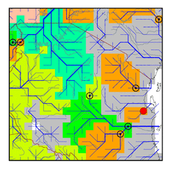
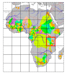
| Station Name (GRDC ID): | Dar-Es-Salam-Morogoro Road Bridge (1289450) | Basin Name: | GHAASBasin817 |
|---|---|---|---|
| River Name: | Ruvu | Next Downstream Station: | None |
| GRDC Country Code: | TN | Distance to Next Downstream Station: | N.A. |
| Start Year [Month]: | 1959 [11] | Upstream Station(s): | None |
| End Year [Month]: | 1978 [12] | ||
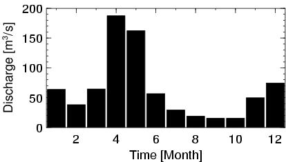
| Mean Discharge: | 65 m3/s | ||
| Minimum Discharge: | 3 m3/s | ||
| Maximum Discharge: | 687 m3/s | Length of Upstream Mainstem: | 189 km |
| Mean Interstation Discharge: | 65 m3/s | Distance to Basin Outlet: | 78 km |
| GRDC Catchment Area: | 15190 km2 | STN Catchment Area: | 15343 km2 |
| GRDC Interstation Area: | 15190 km2 | STN Interstation Area: | 15343 km2 |
| GRDC Station Runoff: | 134 mm/yr | STN Station Runoff: | 133 mm/yr |
| GRDC Interstation Runoff: | 134 mm/yr | STN Interstation Runoff: | 133 mm/yr |
| Station Field Descriptions | Basin Field Descriptions | ||
| Download | |
|---|---|
| Site Descriptor Information | Station Time Series Data |
| Hydrograph | Station Data | ||||||||||||||||||||||||||||||||||||||||||||||||||||||||
|---|---|---|---|---|---|---|---|---|---|---|---|---|---|---|---|---|---|---|---|---|---|---|---|---|---|---|---|---|---|---|---|---|---|---|---|---|---|---|---|---|---|---|---|---|---|---|---|---|---|---|---|---|---|---|---|---|---|
|
| ||||||||||||||||||||||||||||||||||||||||||||||||||||||||
