 |
 |
|
|
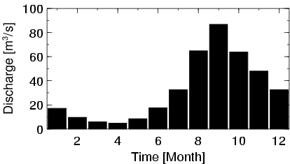
| Station Name (GRDC ID): | Boromo (1931370) | Basin Name: | Volta |
|---|---|---|---|
| River Name: | Mou Houn (Volta Noire) | Next Downstream Station: | Dapola (1931400) |
| GRDC Country Code: | HV | Distance to Next Downstream Station: | 111 km |
| Start Year [Month]: | 1955 [3] | Upstream Station(s): | None |
| End Year [Month]: | 1991 [1] | ||
| Mean Discharge: | 33 m3/s | ||
| Minimum Discharge: | 0 m3/s | ||
| Maximum Discharge: | 166 m3/s | Length of Upstream Mainstem: | 299 km |
| Mean Interstation Discharge: | 33 m3/s | Distance to Basin Outlet: | 1058 km |
| GRDC Catchment Area: | 37140 km2 | STN Catchment Area: | 57323 km2 |
| GRDC Interstation Area: | 37140 km2 | STN Interstation Area: | 57323 km2 |
| GRDC Station Runoff: | 28 mm/yr | STN Station Runoff: | 18 mm/yr |
| GRDC Interstation Runoff: | 28 mm/yr | STN Interstation Runoff: | 18 mm/yr |
| Station Field Descriptions | Basin Field Descriptions | ||
| Download | |
|---|---|
| Site Descriptor Information | Station Time Series Data |
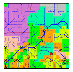
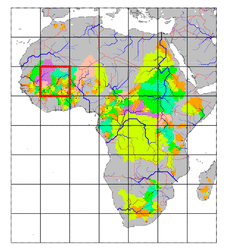
| Hydrograph | Station Data | ||||||||||||||||||||||||||||||||||||||||||||||||||||||||
|---|---|---|---|---|---|---|---|---|---|---|---|---|---|---|---|---|---|---|---|---|---|---|---|---|---|---|---|---|---|---|---|---|---|---|---|---|---|---|---|---|---|---|---|---|---|---|---|---|---|---|---|---|---|---|---|---|---|
|
| ||||||||||||||||||||||||||||||||||||||||||||||||||||||||
