 |
 |
|
|
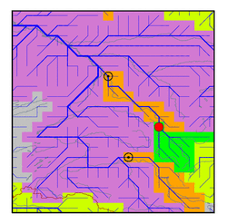
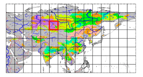
| Station Name (GRDC ID): | Novokuznetsk (2910490) | Basin Name: | Ob |
|---|---|---|---|
| River Name: | Tom | Next Downstream Station: | Tomsk (2910300) |
| GRDC Country Code: | RS | Distance to Next Downstream Station: | 365 km |
| Start Year [Month]: | 1894 [1] | Upstream Station(s): | None |
| End Year [Month]: | 1985 [12] | ||
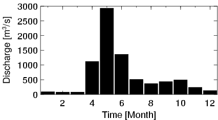
| Mean Discharge: | 651 m3/s | ||
| Minimum Discharge: | 10 m3/s | ||
| Maximum Discharge: | 5030 m3/s | Length of Upstream Mainstem: | 252 km |
| Mean Interstation Discharge: | 651 m3/s | Distance to Basin Outlet: | 2444 km |
| GRDC Catchment Area: | 29800 km2 | STN Catchment Area: | 31441 km2 |
| GRDC Interstation Area: | 29800 km2 | STN Interstation Area: | 31441 km2 |
| GRDC Station Runoff: | 689 mm/yr | STN Station Runoff: | 653 mm/yr |
| GRDC Interstation Runoff: | 689 mm/yr | STN Interstation Runoff: | 653 mm/yr |
| Station Field Descriptions | Basin Field Descriptions | ||
| Download | |
|---|---|
| Site Descriptor Information | Station Time Series Data |
| Hydrograph | Station Data | ||||||||||||||||||||||||||||||||||||||||||||||||||||||||
|---|---|---|---|---|---|---|---|---|---|---|---|---|---|---|---|---|---|---|---|---|---|---|---|---|---|---|---|---|---|---|---|---|---|---|---|---|---|---|---|---|---|---|---|---|---|---|---|---|---|---|---|---|---|---|---|---|---|
|
| ||||||||||||||||||||||||||||||||||||||||||||||||||||||||
