 |
 |
|
|
| Station Name (GRDC ID): | Vorontsovo (2998400) | Basin Name: | Indigirka |
|---|---|---|---|
| River Name: | Indigirka | Next Downstream Station: | None |
| GRDC Country Code: | RS | Distance to Next Downstream Station: | N.A. |
| Start Year [Month]: | 1937 [1] | Upstream Station(s): | Ala-Chubuk (2998600) |
| End Year [Month]: | 1994 [12] | ||
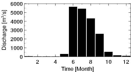
| Mean Discharge: | 1587 m3/s | ||
| Minimum Discharge: | 3 m3/s | ||
| Maximum Discharge: | 10600 m3/s | Length of Upstream Mainstem: | 1148 km |
| Mean Interstation Discharge: | 1471 m3/s | Distance to Basin Outlet: | 286 km |
| GRDC Catchment Area: | 305000 km2 | STN Catchment Area: | 299735 km2 |
| GRDC Interstation Area: | 282700 km2 | STN Interstation Area: | 278200 km2 |
| GRDC Station Runoff: | 164 mm/yr | STN Station Runoff: | 167 mm/yr |
| GRDC Interstation Runoff: | 164 mm/yr | STN Interstation Runoff: | 167 mm/yr |
| Station Field Descriptions | Basin Field Descriptions | ||
| Download | |
|---|---|
| Site Descriptor Information | Station Time Series Data |
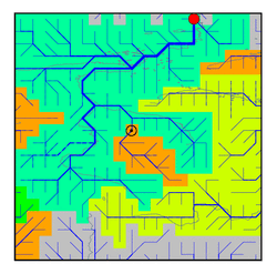
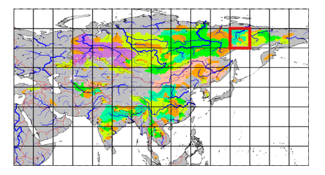
| Hydrograph | Station Data | ||||||||||||||||||||||||||||||||||||||||||||||||||||||||
|---|---|---|---|---|---|---|---|---|---|---|---|---|---|---|---|---|---|---|---|---|---|---|---|---|---|---|---|---|---|---|---|---|---|---|---|---|---|---|---|---|---|---|---|---|---|---|---|---|---|---|---|---|---|---|---|---|---|
|
| ||||||||||||||||||||||||||||||||||||||||||||||||||||||||
