 |
 |
|
|
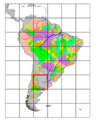
| Station Name (GRDC ID): | Arco del Desaguadero (3275270) | Basin Name: | Colorado (Arg) |
|---|---|---|---|
| River Name: | Desaguadero | Next Downstream Station: | None |
| GRDC Country Code: | AG | Distance to Next Downstream Station: | N.A. |
| Start Year [Month]: | 1936 [9] | Upstream Station(s): | None |
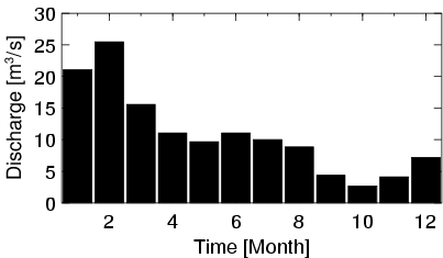
| End Year [Month]: | 1951 [10] | ||
| Mean Discharge: | 11 m3/s | ||
| Minimum Discharge: | 0 m3/s | ||
| Maximum Discharge: | 274 m3/s | Length of Upstream Mainstem: | 148 km |
| Mean Interstation Discharge: | 11 m3/s | Distance to Basin Outlet: | 1020 km |
| GRDC Catchment Area: | 10212 km2 | STN Catchment Area: | 10311 km2 |
| GRDC Interstation Area: | 10212 km2 | STN Interstation Area: | 10311 km2 |
| GRDC Station Runoff: | 34 mm/yr | STN Station Runoff: | 33 mm/yr |
| GRDC Interstation Runoff: | 34 mm/yr | STN Interstation Runoff: | 33 mm/yr |
| Station Field Descriptions | Basin Field Descriptions | ||
| Download | |
|---|---|
| Site Descriptor Information | Station Time Series Data |
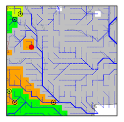
| Hydrograph | Station Data | ||||||||||||||||||||||||||||||||||||||||||||||||||||||||
|---|---|---|---|---|---|---|---|---|---|---|---|---|---|---|---|---|---|---|---|---|---|---|---|---|---|---|---|---|---|---|---|---|---|---|---|---|---|---|---|---|---|---|---|---|---|---|---|---|---|---|---|---|---|---|---|---|---|
|
| ||||||||||||||||||||||||||||||||||||||||||||||||||||||||
