 |
 |
|
|
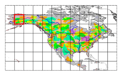
| Station Name (GRDC ID): | Susitna Station (4102800) | Basin Name: | GHAASBasin321 |
|---|---|---|---|
| River Name: | Susitna | Next Downstream Station: | None |
| GRDC Country Code: | US | Distance to Next Downstream Station: | N.A. |
| Start Year [Month]: | 1974 [10] | Upstream Station(s): | None |
| End Year [Month]: | 1993 [3] | ||
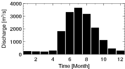
| Mean Discharge: | 1401 m3/s | ||
| Minimum Discharge: | 150 m3/s | ||
| Maximum Discharge: | 5082 m3/s | Length of Upstream Mainstem: | 367 km |
| Mean Interstation Discharge: | 1401 m3/s | Distance to Basin Outlet: | 62 km |
| GRDC Catchment Area: | 50246 km2 | STN Catchment Area: | 45580 km2 |
| GRDC Interstation Area: | 50246 km2 | STN Interstation Area: | 45580 km2 |
| GRDC Station Runoff: | 879 mm/yr | STN Station Runoff: | 969 mm/yr |
| GRDC Interstation Runoff: | 879 mm/yr | STN Interstation Runoff: | 969 mm/yr |
| Station Field Descriptions | Basin Field Descriptions | ||
| Download | |
|---|---|
| Site Descriptor Information | Station Time Series Data |
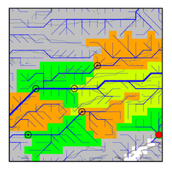
| Hydrograph | Station Data | ||||||||||||||||||||||||||||||||||||||||||||||||||||||||
|---|---|---|---|---|---|---|---|---|---|---|---|---|---|---|---|---|---|---|---|---|---|---|---|---|---|---|---|---|---|---|---|---|---|---|---|---|---|---|---|---|---|---|---|---|---|---|---|---|---|---|---|---|---|---|---|---|---|
|
| ||||||||||||||||||||||||||||||||||||||||||||||||||||||||
