 |
 |
|
|
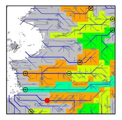
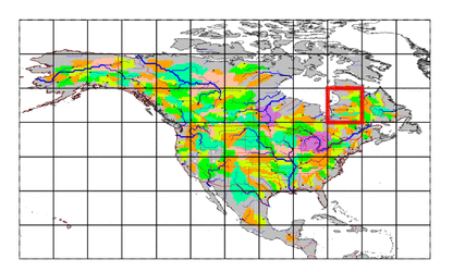
| Station Name (GRDC ID): | en aval du Lac Nemiscau (4214680) | Basin Name: | Rupert |
|---|---|---|---|
| River Name: | Rupert | Next Downstream Station: | None |
| GRDC Country Code: | CN | Distance to Next Downstream Station: | N.A. |
| Start Year [Month]: | 1966 [1] | Upstream Station(s): | None |
| End Year [Month]: | 1984 [12] | ||
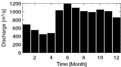
| Mean Discharge: | 864 m3/s | ||
| Minimum Discharge: | 329 m3/s | ||
| Maximum Discharge: | 1780 m3/s | Length of Upstream Mainstem: | 444 km |
| Mean Interstation Discharge: | 864 m3/s | Distance to Basin Outlet: | 238 km |
| GRDC Catchment Area: | 40900 km2 | STN Catchment Area: | 44396 km2 |
| GRDC Interstation Area: | 40900 km2 | STN Interstation Area: | 44396 km2 |
| GRDC Station Runoff: | 666 mm/yr | STN Station Runoff: | 614 mm/yr |
| GRDC Interstation Runoff: | 666 mm/yr | STN Interstation Runoff: | 614 mm/yr |
| Station Field Descriptions | Basin Field Descriptions | ||
| Download | |
|---|---|
| Site Descriptor Information | Station Time Series Data |
| Hydrograph | Station Data | ||||||||||||||||||||||||||||||||||||||||||||||||||||||||
|---|---|---|---|---|---|---|---|---|---|---|---|---|---|---|---|---|---|---|---|---|---|---|---|---|---|---|---|---|---|---|---|---|---|---|---|---|---|---|---|---|---|---|---|---|---|---|---|---|---|---|---|---|---|---|---|---|---|
|
| ||||||||||||||||||||||||||||||||||||||||||||||||||||||||
