 |
 |
|
|
| Station Name (GRDC ID): | near The mouth (6854700) | Basin Name: | Kemijoki |
|---|---|---|---|
| River Name: | Kenijoki | Next Downstream Station: | None |
| GRDC Country Code: | FI | Distance to Next Downstream Station: | N.A. |
| Start Year [Month]: | 1949 [1] | Upstream Station(s): | None |
| End Year [Month]: | 1992 [12] | ||
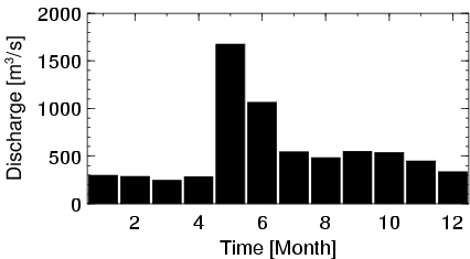
| Mean Discharge: | 562 m3/s | ||
| Minimum Discharge: | 104 m3/s | ||
| Maximum Discharge: | 3168 m3/s | Length of Upstream Mainstem: | 444 km |
| Mean Interstation Discharge: | 562 m3/s | Distance to Basin Outlet: | 60 km |
| GRDC Catchment Area: | 50900 km2 | STN Catchment Area: | 50179 km2 |
| GRDC Interstation Area: | 50900 km2 | STN Interstation Area: | 50179 km2 |
| GRDC Station Runoff: | 348 mm/yr | STN Station Runoff: | 353 mm/yr |
| GRDC Interstation Runoff: | 348 mm/yr | STN Interstation Runoff: | 353 mm/yr |
| Station Field Descriptions | Basin Field Descriptions | ||
| Download | |
|---|---|
| Site Descriptor Information | Station Time Series Data |
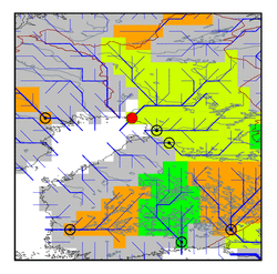
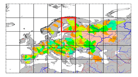
| Hydrograph | Station Data | ||||||||||||||||||||||||||||||||||||||||||||||||||||||||
|---|---|---|---|---|---|---|---|---|---|---|---|---|---|---|---|---|---|---|---|---|---|---|---|---|---|---|---|---|---|---|---|---|---|---|---|---|---|---|---|---|---|---|---|---|---|---|---|---|---|---|---|---|---|---|---|---|---|
|
| ||||||||||||||||||||||||||||||||||||||||||||||||||||||||
