 |
 |
|
|
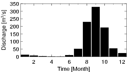
| Station Name (GRDC ID): | Toukoto (1112340) | Basin Name: | Senegal |
|---|---|---|---|
| River Name: | Bakoye | Next Downstream Station: | Galougo (1112300) |
| GRDC Country Code: | MI | Distance to Next Downstream Station: | 209 km |
| Start Year [Month]: | 1952 [5] | Upstream Station(s): | None |
| End Year [Month]: | 1990 [12] | ||
| Mean Discharge: | 76 m3/s | ||
| Minimum Discharge: | 0 m3/s | ||
| Maximum Discharge: | 693 m3/s | Length of Upstream Mainstem: | 289 km |
| Mean Interstation Discharge: | 76 m3/s | Distance to Basin Outlet: | 963 km |
| GRDC Catchment Area: | 16000 km2 | STN Catchment Area: | 18107 km2 |
| GRDC Interstation Area: | 16000 km2 | STN Interstation Area: | 18107 km2 |
| GRDC Station Runoff: | 149 mm/yr | STN Station Runoff: | 132 mm/yr |
| GRDC Interstation Runoff: | 149 mm/yr | STN Interstation Runoff: | 132 mm/yr |
| Station Field Descriptions | Basin Field Descriptions | ||
| Download | |
|---|---|
| Site Descriptor Information | Station Time Series Data |
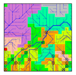
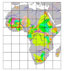
| Hydrograph | Station Data | ||||||||||||||||||||||||||||||||||||||||||||||||||||||||
|---|---|---|---|---|---|---|---|---|---|---|---|---|---|---|---|---|---|---|---|---|---|---|---|---|---|---|---|---|---|---|---|---|---|---|---|---|---|---|---|---|---|---|---|---|---|---|---|---|---|---|---|---|---|---|---|---|---|
|
| ||||||||||||||||||||||||||||||||||||||||||||||||||||||||
