 |
 |
|
|
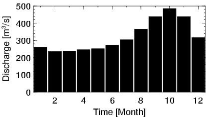
| Station Name (GRDC ID): | M'bata (1749050) | Basin Name: | Zaire |
|---|---|---|---|
| River Name: | Lobaye | Next Downstream Station: | Bangui (1749100) |
| GRDC Country Code: | CE | Distance to Next Downstream Station: | 111 km |
| Start Year [Month]: | 1950 [11] | Upstream Station(s): | None |
| End Year [Month]: | 1994 [3] | ||
| Mean Discharge: | 321 m3/s | ||
| Minimum Discharge: | 110 m3/s | ||
| Maximum Discharge: | 688 m3/s | Length of Upstream Mainstem: | 402 km |
| Mean Interstation Discharge: | 321 m3/s | Distance to Basin Outlet: | 1596 km |
| GRDC Catchment Area: | 31000 km2 | STN Catchment Area: | 36972 km2 |
| GRDC Interstation Area: | 31000 km2 | STN Interstation Area: | 36972 km2 |
| GRDC Station Runoff: | 326 mm/yr | STN Station Runoff: | 274 mm/yr |
| GRDC Interstation Runoff: | 326 mm/yr | STN Interstation Runoff: | 274 mm/yr |
| Station Field Descriptions | Basin Field Descriptions | ||
| Download | |
|---|---|
| Site Descriptor Information | Station Time Series Data |
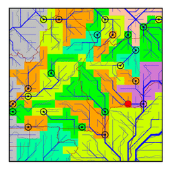
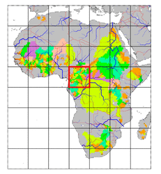
| Hydrograph | Station Data | ||||||||||||||||||||||||||||||||||||||||||||||||||||||||
|---|---|---|---|---|---|---|---|---|---|---|---|---|---|---|---|---|---|---|---|---|---|---|---|---|---|---|---|---|---|---|---|---|---|---|---|---|---|---|---|---|---|---|---|---|---|---|---|---|---|---|---|---|---|---|---|---|---|
|
| ||||||||||||||||||||||||||||||||||||||||||||||||||||||||
