 |
 |
|
|
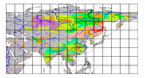
| Station Name (GRDC ID): | Chabda (2903080) | Basin Name: | Lena |
|---|---|---|---|
| River Name: | Maya | Next Downstream Station: | Stolb (2903430) |
| GRDC Country Code: | RS | Distance to Next Downstream Station: | 1991 km |
| Start Year [Month]: | 1965 [1] | Upstream Station(s): | None |
| End Year [Month]: | 1984 [12] | ||
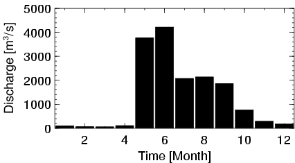
| Mean Discharge: | 1301 m3/s | ||
| Minimum Discharge: | 5 m3/s | ||
| Maximum Discharge: | 8110 m3/s | Length of Upstream Mainstem: | 731 km |
| Mean Interstation Discharge: | 1301 m3/s | Distance to Basin Outlet: | 2107 km |
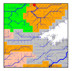
| GRDC Catchment Area: | 165000 km2 | STN Catchment Area: | 162522 km2 |
| GRDC Interstation Area: | 165000 km2 | STN Interstation Area: | 162522 km2 |
| GRDC Station Runoff: | 249 mm/yr | STN Station Runoff: | 252 mm/yr |
| GRDC Interstation Runoff: | 249 mm/yr | STN Interstation Runoff: | 252 mm/yr |
| Station Field Descriptions | Basin Field Descriptions | ||
| Download | |
|---|---|
| Site Descriptor Information | Station Time Series Data |
| Hydrograph | Station Data | ||||||||||||||||||||||||||||||||||||||||||||||||||||||||
|---|---|---|---|---|---|---|---|---|---|---|---|---|---|---|---|---|---|---|---|---|---|---|---|---|---|---|---|---|---|---|---|---|---|---|---|---|---|---|---|---|---|---|---|---|---|---|---|---|---|---|---|---|---|---|---|---|---|
|
| ||||||||||||||||||||||||||||||||||||||||||||||||||||||||
