 |
 |
|
|
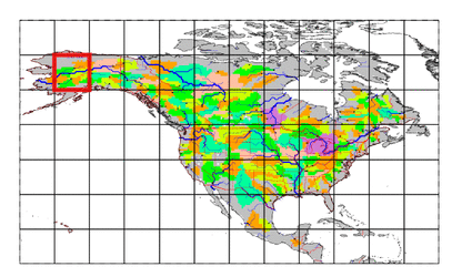
| Station Name (GRDC ID): | Mcgrath (4102110) | Basin Name: | Kuskowin |
|---|---|---|---|
| River Name: | Kuskokwim | Next Downstream Station: | Crooked Creek, Alas. (4102100) |
| GRDC Country Code: | US | Distance to Next Downstream Station: | 289 km |
| Start Year [Month]: | 1963 [7] | Upstream Station(s): | None |
| End Year [Month]: | 1973 [9] | ||
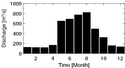
| Mean Discharge: | 381 m3/s | ||
| Minimum Discharge: | 78 m3/s | ||
| Maximum Discharge: | 1450 m3/s | Length of Upstream Mainstem: | 306 km |
| Mean Interstation Discharge: | 381 m3/s | Distance to Basin Outlet: | 643 km |
| GRDC Catchment Area: | 30303 km2 | STN Catchment Area: | 30993 km2 |
| GRDC Interstation Area: | 30303 km2 | STN Interstation Area: | 30993 km2 |
| GRDC Station Runoff: | 397 mm/yr | STN Station Runoff: | 388 mm/yr |
| GRDC Interstation Runoff: | 397 mm/yr | STN Interstation Runoff: | 388 mm/yr |
| Station Field Descriptions | Basin Field Descriptions | ||
| Download | |
|---|---|
| Site Descriptor Information | Station Time Series Data |
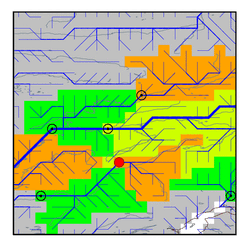
| Hydrograph | Station Data | ||||||||||||||||||||||||||||||||||||||||||||||||||||||||
|---|---|---|---|---|---|---|---|---|---|---|---|---|---|---|---|---|---|---|---|---|---|---|---|---|---|---|---|---|---|---|---|---|---|---|---|---|---|---|---|---|---|---|---|---|---|---|---|---|---|---|---|---|---|---|---|---|---|
|
| ||||||||||||||||||||||||||||||||||||||||||||||||||||||||
