 |
 |
|
|
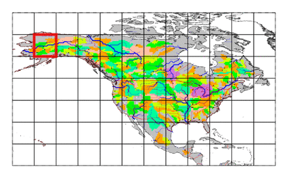
| Station Name (GRDC ID): | Kaltag, Alas. (4103300) | Basin Name: | Yukon |
|---|---|---|---|
| River Name: | Yukon | Next Downstream Station: | Pilot Station (4103200) |
| GRDC Country Code: | US | Distance to Next Downstream Station: | 439 km |
| Start Year [Month]: | 1956 [10] | Upstream Station(s): | Ruby, Alas. (4103450) Hughes, Alas. (4103500) |
| End Year [Month]: | 1966 [9] | ||
| Mean Discharge: | 6040 m3/s | ||
| Minimum Discharge: | 560 m3/s | ||
| Maximum Discharge: | 26398 m3/s | Length of Upstream Mainstem: | 2112 km |
| Mean Interstation Discharge: | 1443 m3/s | Distance to Basin Outlet: | 665 km |
| GRDC Catchment Area: | 767000 km2 | STN Catchment Area: | 768981 km2 |
| GRDC Interstation Area: | 47757 km2 | STN Interstation Area: | 51739 km2 |
| GRDC Station Runoff: | 248 mm/yr | STN Station Runoff: | 248 mm/yr |
| GRDC Interstation Runoff: | 953 mm/yr | STN Interstation Runoff: | 880 mm/yr |
| Station Field Descriptions | Basin Field Descriptions | ||
| Download | |
|---|---|
| Site Descriptor Information | Station Time Series Data |
| Hydrograph | Station Data | ||||||||||||||||||||||||||||||||||||||||||||||||||||||||
|---|---|---|---|---|---|---|---|---|---|---|---|---|---|---|---|---|---|---|---|---|---|---|---|---|---|---|---|---|---|---|---|---|---|---|---|---|---|---|---|---|---|---|---|---|---|---|---|---|---|---|---|---|---|---|---|---|---|

|
| ||||||||||||||||||||||||||||||||||||||||||||||||||||||||
