 |
 |
|
|
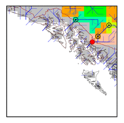
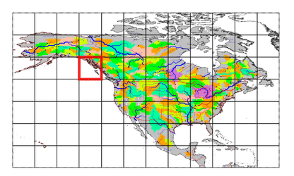
| Station Name (GRDC ID): | near Wrangell (4204900) | Basin Name: | Stikine |
|---|---|---|---|
| River Name: | Stikine | Next Downstream Station: | None |
| GRDC Country Code: | US | Distance to Next Downstream Station: | N.A. |
| Start Year [Month]: | 1976 [7] | Upstream Station(s): | above Butterfly Creek (4204050) |
| End Year [Month]: | 1993 [9] | ||
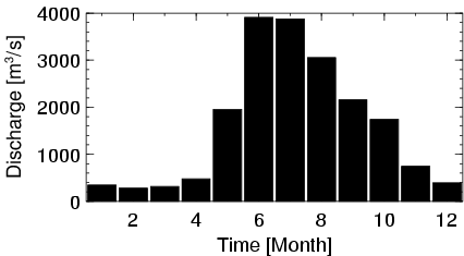
| Mean Discharge: | 1604 m3/s | ||
| Minimum Discharge: | 132 m3/s | ||
| Maximum Discharge: | 5620 m3/s | Length of Upstream Mainstem: | 546 km |
| Mean Interstation Discharge: | 973 m3/s | Distance to Basin Outlet: | 64 km |
| GRDC Catchment Area: | 51593 km2 | STN Catchment Area: | 51316 km2 |
| GRDC Interstation Area: | 15593 km2 | STN Interstation Area: | 16813 km2 |
| GRDC Station Runoff: | 980 mm/yr | STN Station Runoff: | 986 mm/yr |
| GRDC Interstation Runoff: | 1968 mm/yr | STN Interstation Runoff: | 1825 mm/yr |
| Station Field Descriptions | Basin Field Descriptions | ||
| Download | |
|---|---|
| Site Descriptor Information | Station Time Series Data |
| Hydrograph | Station Data | ||||||||||||||||||||||||||||||||||||||||||||||||||||||||
|---|---|---|---|---|---|---|---|---|---|---|---|---|---|---|---|---|---|---|---|---|---|---|---|---|---|---|---|---|---|---|---|---|---|---|---|---|---|---|---|---|---|---|---|---|---|---|---|---|---|---|---|---|---|---|---|---|---|
|
| ||||||||||||||||||||||||||||||||||||||||||||||||||||||||
