 |
 |
|
|
| Station Name (GRDC ID): | near Fort Providence (4208300) | Basin Name: | Mackenzie |
|---|---|---|---|
| River Name: | Mackenzie River | Next Downstream Station: | Norman Wells (4208150) |
| GRDC Country Code: | CN | Distance to Next Downstream Station: | 883 km |
| Start Year [Month]: | 1958 [3] | Upstream Station(s): | Fitzgerald (4208400) |
| End Year [Month]: | 1978 [11] | ||
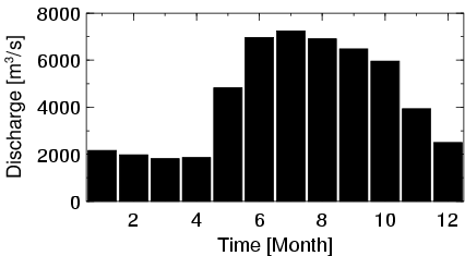
| Mean Discharge: | 4385 m3/s | ||
| Minimum Discharge: | 1191 m3/s | ||
| Maximum Discharge: | 8843 m3/s | Length of Upstream Mainstem: | 2075 km |
| Mean Interstation Discharge: | 975 m3/s | Distance to Basin Outlet: | 1631 km |
| GRDC Catchment Area: | 970000 km2 | STN Catchment Area: | 970216 km2 |
| GRDC Interstation Area: | 364000 km2 | STN Interstation Area: | 359594 km2 |
| GRDC Station Runoff: | 143 mm/yr | STN Station Runoff: | 143 mm/yr |
| GRDC Interstation Runoff: | 85 mm/yr | STN Interstation Runoff: | 86 mm/yr |
| Station Field Descriptions | Basin Field Descriptions | ||
| Download | |
|---|---|
| Site Descriptor Information | Station Time Series Data |
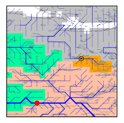
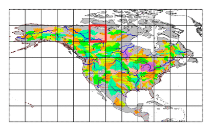
| Hydrograph | Station Data | ||||||||||||||||||||||||||||||||||||||||||||||||||||||||
|---|---|---|---|---|---|---|---|---|---|---|---|---|---|---|---|---|---|---|---|---|---|---|---|---|---|---|---|---|---|---|---|---|---|---|---|---|---|---|---|---|---|---|---|---|---|---|---|---|---|---|---|---|---|---|---|---|---|
|
| ||||||||||||||||||||||||||||||||||||||||||||||||||||||||
